
Puerto Iguazú topographic map
Interactive map
Click on the map to display elevation.
About this map
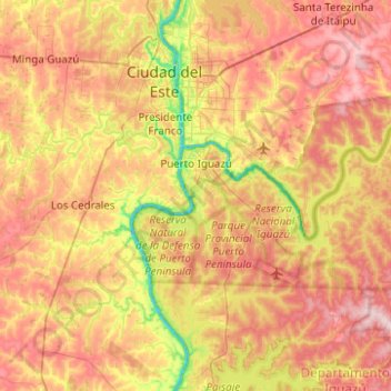
Name: Puerto Iguazú topographic map, elevation, terrain.
Location: Puerto Iguazú, Departamento Iguazú, Misiones, Argentina (-25.76171 -54.65822 -25.53455 -54.16163)
Average elevation: 732 ft
Minimum elevation: 292 ft
Maximum elevation: 1,165 ft