
Koriyama topographic map
Interactive map
Click on the map to display elevation.
About this map
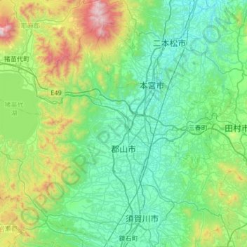
Name: Koriyama topographic map, elevation, terrain.
Location: Koriyama, Fukushima Prefecture, Japan (37.26603 140.03598 37.62598 140.56439)
Average elevation: 1,575 ft
Minimum elevation: 531 ft
Maximum elevation: 5,840 ft
Other topographic maps
Click on a map to view its topography, its elevation and its terrain.