
Ağaçören topographic map
Interactive map
Click on the map to display elevation.
About this map
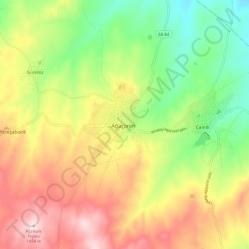
Name: Ağaçören topographic map, elevation, terrain.
Location: Ağaçören, Aksaray, Central Anatolia Region, Turkey (38.82909 33.87620 38.90909 33.95620)
Average elevation: 4,019 ft
Minimum elevation: 3,360 ft
Maximum elevation: 4,777 ft