
Talatha Gardens topographic map
Interactive map
Click on the map to display elevation.
About this map
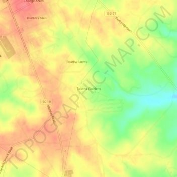
Name: Talatha Gardens topographic map, elevation, terrain.
Location: Talatha Gardens, Aiken County, South Carolina, 29803, USA (33.45604 -81.70017 33.49604 -81.66017)
Average elevation: 433 ft
Minimum elevation: 299 ft
Maximum elevation: 522 ft