
Arriondas / Les Arriondes topographic map
Interactive map
Click on the map to display elevation.
About this map
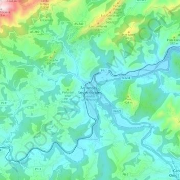
Name: Arriondas / Les Arriondes topographic map, elevation, terrain.
Location: Arriondas / Les Arriondes, Parres, Asturias, 33540, Spain (43.34922 -5.22487 43.42922 -5.14487)
Average elevation: 614 ft
Minimum elevation: 39 ft
Maximum elevation: 3,120 ft