
Flamenco topographic map
Interactive map
Click on the map to display elevation.
About this map
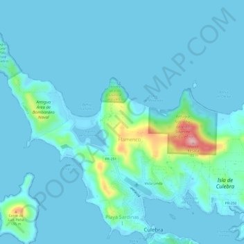
Name: Flamenco topographic map, elevation, terrain.
Location: Flamenco, Culebra, Puerto Rico, USA (18.30534 -65.34428 18.35024 -65.28512)
Average elevation: 66 ft
Minimum elevation: -10 ft
Maximum elevation: 617 ft
Other topographic maps
Click on a map to view its topography, its elevation and its terrain.
Desecheo Island
USA > Puerto Rico > Mayagüez
Desecheo Island, Mayagüez, Puerto Rico, USA
Average elevation: 30 ft