
Groenendaal topographic map
Interactive map
Click on the map to display elevation.
About this map
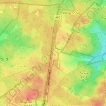
Name: Groenendaal topographic map, elevation, terrain.
Location: Groenendaal, Gelderland, Nederland, 7371, Nederland (52.06141 5.92778 52.10141 5.96778)
Average elevation: 259 ft
Minimum elevation: 151 ft
Maximum elevation: 338 ft