
Duram topographic map
Interactive map
Click on the map to display elevation.
About this map
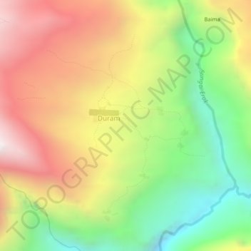
Name: Duram topographic map, elevation, terrain.
Location: Duram, Yahukimo, Papua, Indonesia (-4.49523 139.60180 -4.45523 139.64180)
Average elevation: 7,021 ft
Minimum elevation: 4,541 ft
Maximum elevation: 9,665 ft