
Baztán topographic map
Interactive map
Click on the map to display elevation.
About this map
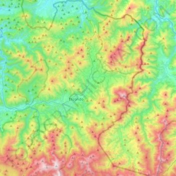
Name: Baztán topographic map, elevation, terrain.
Location: Baztán, Baztan-Bidasoa, España (43.03106 -1.64723 43.29467 -1.37638)
Average elevation: 1,709 ft
Minimum elevation: 161 ft
Maximum elevation: 4,610 ft
Baztán está situado al norte de la Comunidad Foral de Navarra dentro de la región geográfica de la Montaña de Navarra. Su término municipal tiene una superficie de 376,81 km² y su capital está situada a 200 m s.n.m. de altitud.
Other topographic maps
Click on a map to view its topography, its elevation and its terrain.