
Akhisar topographic map
Interactive map
Click on the map to display elevation.
About this map
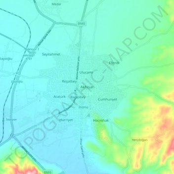
Name: Akhisar topographic map, elevation, terrain.
Location: Akhisar, Manisa, Aegean Region, 45200, Turkey (38.88405 27.80019 38.96405 27.88019)
Average elevation: 407 ft
Minimum elevation: 266 ft
Maximum elevation: 1,119 ft