
Black River topographic map
Interactive map
Click on the map to display elevation.
About this map
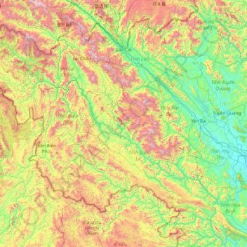
Name: Black River topographic map, elevation, terrain.
Average elevation: 2,579 ft
Minimum elevation: 26 ft
Maximum elevation: 10,092 ft
Other topographic maps
Click on a map to view its topography, its elevation and its terrain.
Quỳnh Nhai District
Quỳnh Nhai District, Sơn La Province, Vietnam
Average elevation: 2,320 ft
Moc Chau
Vietnam > Son La province > Mộc Châu District
Moc Chau, Mộc Châu District, Sơn La Province, 34719, Vietnam
Average elevation: 3,005 ft
Chieng khoa watefall
Vietnam > Son La province > Vân Hồ District > Mường Khoa
Chieng khoa watefall, Mường Khoa, Vân Hồ District, Sơn La Province, Vietnam
Average elevation: 1,273 ft
Mường La District
Mường La District, Son La province, Vietnam
Average elevation: 3,468 ft