
Gondar topographic map
Interactive map
Click on the map to display elevation.
About this map
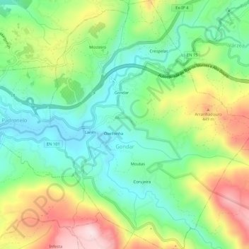
Name: Gondar topographic map, elevation, terrain.
Location: Gondar, Amarante, Porto, Tâmega e Sousa, North, Portugal (41.23259 -8.04288 41.27227 -7.99963)
Average elevation: 978 ft
Minimum elevation: 489 ft
Maximum elevation: 1,804 ft