
坂ノ下 topographic map
Interactive map
Click on the map to display elevation.
About this map
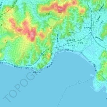
Name: 坂ノ下 topographic map, elevation, terrain.
Location: 坂ノ下, Kamakura, Kanagawa Prefecture, Kanto, 248-0021, Japan (35.28871 139.51318 35.32871 139.55318)
Average elevation: 69 ft
Minimum elevation: -13 ft
Maximum elevation: 348 ft