
La Lorrain topographic map
Interactive map
Click on the map to display elevation.
About this map
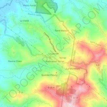
Name: La Lorrain topographic map, elevation, terrain.
Location: La Lorrain, Le Marin, Martinique, 97211, France (14.51386 -60.95297 14.55386 -60.91297)
Average elevation: 446 ft
Minimum elevation: 16 ft
Maximum elevation: 1,109 ft