
Machuelo Abajo topographic map
Interactive map
Click on the map to display elevation.
About this map
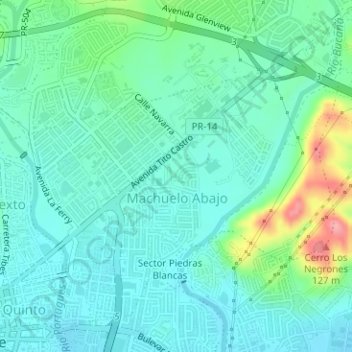
Name: Machuelo Abajo topographic map, elevation, terrain.
Location: Machuelo Abajo, Ponce, Puerto Rico, United States (18.01247 -66.61362 18.03894 -66.58213)
Average elevation: 128 ft
Minimum elevation: 43 ft
Maximum elevation: 410 ft
Other topographic maps
Click on a map to view its topography, its elevation and its terrain.
Cerro de Punta
United States > Puerto Rico > Ponce
Cerro de Punta, Ponce, Puerto Rico, 00664, United States
Average elevation: 3,350 ft