
Collinsville topographic map
Interactive map
Click on the map to display elevation.
About this map
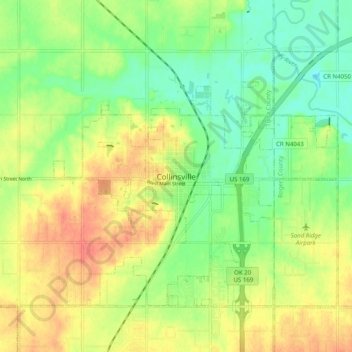
Name: Collinsville topographic map, elevation, terrain.
Location: Collinsville, Tulsa County, Oklahoma, 74021, USA (36.32612 -95.87981 36.40612 -95.79981)
Average elevation: 653 ft
Minimum elevation: 571 ft
Maximum elevation: 745 ft