
Fort Supply topographic map
Interactive map
Click on the map to display elevation.
About this map
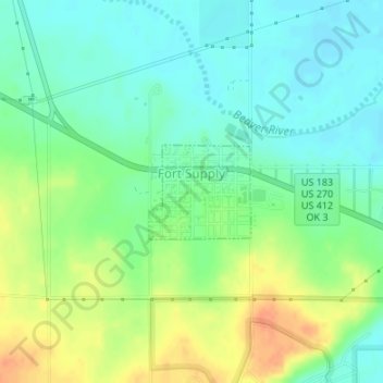
Name: Fort Supply topographic map, elevation, terrain.
Location: Fort Supply, Woodward County, Oklahoma, 73841, United States (36.56874 -99.57830 36.57540 -99.56936)
Average elevation: 2,024 ft
Minimum elevation: 1,975 ft
Maximum elevation: 2,103 ft
Other topographic maps
Click on a map to view its topography, its elevation and its terrain.
Woodward
United States > Oklahoma > Woodward County
Woodward, Woodward County, Oklahoma, 73801, United States
Average elevation: 1,995 ft
Mooreland
United States > Oklahoma > Woodward County > Mooreland
Mooreland, Woodward County, Oklahoma, 73852, United States
Average elevation: 1,903 ft