
Güroymak topographic map
Interactive map
Click on the map to display elevation.
About this map
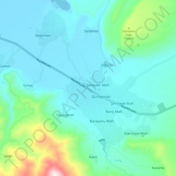
Name: Güroymak topographic map, elevation, terrain.
Location: Güroymak, Bitlis, Eastern Anatolia Region, 13200, Turkey (38.53417 41.98533 38.61417 42.06533)
Average elevation: 4,767 ft
Minimum elevation: 4,203 ft
Maximum elevation: 7,507 ft