
Griffin topographic map
Interactive map
Click on the map to display elevation.
About this map
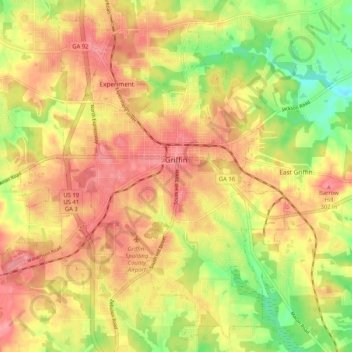
Name: Griffin topographic map, elevation, terrain.
Location: Griffin, Spalding County, Georgia, 30224, United States (33.20226 -84.32914 33.28298 -84.22553)
Average elevation: 886 ft
Minimum elevation: 722 ft
Maximum elevation: 1,001 ft
Other topographic maps
Click on a map to view its topography, its elevation and its terrain.
Experiment
United States > Georgia > Spalding County
Experiment, Spalding County, Georgia, 30223, United States
Average elevation: 919 ft
Orchard Hill
United States > Georgia > Spalding County
Orchard Hill, Spalding County, Georgia, United States
Average elevation: 830 ft