
Château d'Azay-le-Ferron topographic map
Interactive map
Click on the map to display elevation.
About this map
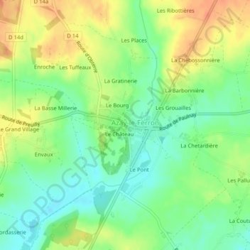
Name: Château d'Azay-le-Ferron topographic map, elevation, terrain.
Average elevation: 371 ft
Minimum elevation: 305 ft
Maximum elevation: 446 ft
Other topographic maps
Click on a map to view its topography, its elevation and its terrain.
Les Bouches
France > Centre-Val de Loire > Azay-le-Ferron > Les Bouches
Les Bouches, Azay-le-Ferron, Le Blanc, Indre, Centre-Val de Loire, France métropolitaine, 36290, France
Average elevation: 381 ft