
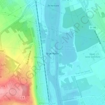
Île du Platais topographic map
Interactive map
Click on the map to display elevation.
About this map
Name: Île du Platais topographic map, elevation, terrain.
Average elevation: 148 ft
Minimum elevation: 56 ft
Maximum elevation: 430 ft
Other topographic maps
Click on a map to view its topography, its elevation and its terrain.
Château de Médan
France > Île-de-France > Médan
Château de Médan, Rue Pierre Curie, Médan, Saint-Germain-en-Laye, Yvelines, Île-de-France, France métropolitaine, 78670, France
Average elevation: 187 ft