
Khariaguda topographic map
Interactive map
Click on the map to display elevation.
About this map
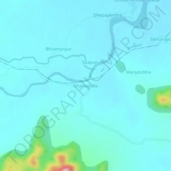
Name: Khariaguda topographic map, elevation, terrain.
Location: Khariaguda, Jarada, Ganjam District, Odisha, 761209, India (19.15912 84.44280 19.19912 84.48280)
Average elevation: 236 ft
Minimum elevation: 154 ft
Maximum elevation: 955 ft
Other topographic maps
Click on a map to view its topography, its elevation and its terrain.
Subarnapur
Subarnapur, Jarada, Ganjam District, Odisha, 761005, India
Average elevation: 269 ft