
Sainte-Anne topographic map
Interactive map
Click on the map to display elevation.
About this map
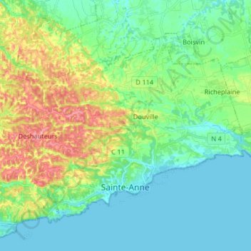
Name: Sainte-Anne topographic map, elevation, terrain.
Location: Sainte-Anne, Pointe-à-Pitre, Guadeloupe, 97180, France (16.21000 -61.45512 16.30280 -61.32417)
Average elevation: 118 ft
Minimum elevation: -3 ft
Maximum elevation: 420 ft