
Bala topographic map
Interactive map
Click on the map to display elevation.
About this map
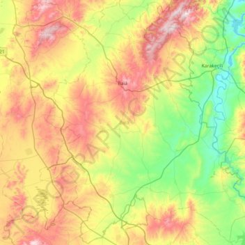
Name: Bala topographic map, elevation, terrain.
Location: Bala, Ankara, Central Anatolia Region, Turkey (39.19594 32.84054 39.73475 33.54517)
Average elevation: 3,389 ft
Minimum elevation: 2,343 ft
Maximum elevation: 5,089 ft