
Elwood topographic map
Interactive map
Click on the map to display elevation.
About this map
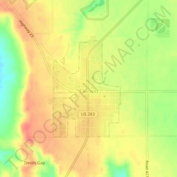
Name: Elwood topographic map, elevation, terrain.
Location: Elwood, Gosper County, Nebraska, United States (40.58338 -99.86834 40.59804 -99.85484)
Average elevation: 2,664 ft
Minimum elevation: 2,549 ft
Maximum elevation: 2,733 ft
Other topographic maps
Click on a map to view its topography, its elevation and its terrain.
Smithfield
United States > Nebraska > Gosper County
Smithfield, Gosper County, Nebraska, United States
Average elevation: 2,549 ft
Johnson Lake
United States > Nebraska > Gosper County
Johnson Lake, Gosper County, Nebraska, United States
Average elevation: 2,618 ft