
Ad Douiem topographic map
Interactive map
Click on the map to display elevation.
About this map
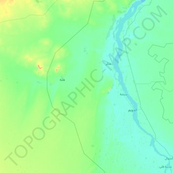
Name: Ad Douiem topographic map, elevation, terrain.
Location: Ad Douiem, White Nile State, Sudan (13.45191 31.55231 14.93221 32.63199)
Average elevation: 1,332 ft
Minimum elevation: 1,240 ft
Maximum elevation: 2,096 ft
Other topographic maps
Click on a map to view its topography, its elevation and its terrain.
Wakara
Sudan > White Nile State > Ad Douiem
Wakara, Ad Douiem, White Nile State, Sudan
Average elevation: 1,253 ft
Al Qutaynah
Sudan > White Nile State > Al Gutaina
Al Qutaynah, Al Gutaina, White Nile State, Sudan
Average elevation: 1,257 ft