
Avalon topographic map
Interactive map
Click on the map to display elevation.
About this map
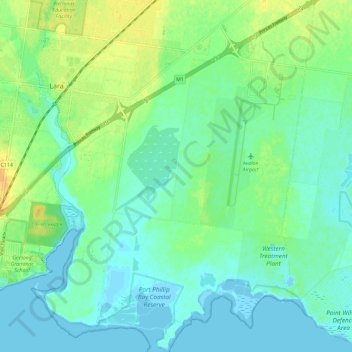
Name: Avalon topographic map, elevation, terrain.
Average elevation: 30 ft
Minimum elevation: -33 ft
Maximum elevation: 92 ft
Other topographic maps
Click on a map to view its topography, its elevation and its terrain.
Lara District
Australia > Victoria > Geelong
Lara District, Victoria, Australia
Average elevation: 308 ft
Waurn Ponds
Australia > Victoria > Geelong
Waurn Ponds, Geelong, City of Greater Geelong, Barwon South West, Victoria, 3216, Australia
Average elevation: 223 ft