
Asahikawa topographic map
Interactive map
Click on the map to display elevation.
About this map
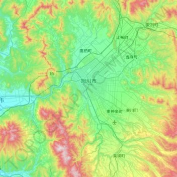
Name: Asahikawa topographic map, elevation, terrain.
Location: Asahikawa, 上川総合振興局, Prefectura de Hokkaidō, 北海道地方, Japón (43.54430 142.14825 43.95622 142.74154)
Average elevation: 912 ft
Minimum elevation: 167 ft
Maximum elevation: 2,956 ft
Other topographic maps
Click on a map to view its topography, its elevation and its terrain.