
The Folly topographic map
Interactive map
Click on the map to display elevation.
About this map
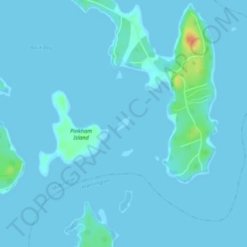
Name: The Folly topographic map, elevation, terrain.
Average elevation: 10 ft
Minimum elevation: -3 ft
Maximum elevation: 135 ft
Other topographic maps
Click on a map to view its topography, its elevation and its terrain.
Turner Hill
United States > Maine > Milbridge
Turner Hill, Milbridge, Washington County, Maine, 04658, United States
Average elevation: 39 ft