
Kaero topographic map
Interactive map
Click on the map to display elevation.
About this map
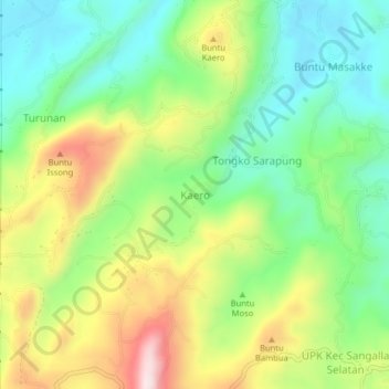
Name: Kaero topographic map, elevation, terrain.
Location: Kaero, Tana Toraja Regency, South Sulawesi, Indonesia (-3.13568 119.89682 -3.09568 119.93682)
Average elevation: 3,081 ft
Minimum elevation: 2,556 ft
Maximum elevation: 3,921 ft