
Point Lookout topographic map
Interactive map
Click on the map to display elevation.
About this map
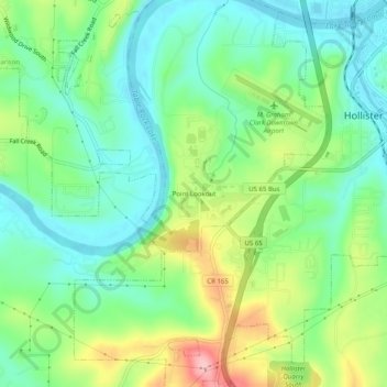
Name: Point Lookout topographic map, elevation, terrain.
Location: Point Lookout, Taney County, Missouri, 65726, USA (36.59610 -93.25984 36.63610 -93.21984)
Average elevation: 863 ft
Minimum elevation: 689 ft
Maximum elevation: 1,211 ft