
Çiçekdağı topographic map
Interactive map
Click on the map to display elevation.
About this map
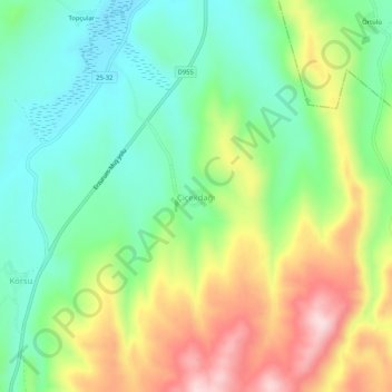
Name: Çiçekdağı topographic map, elevation, terrain.
Location: Çiçekdağı, Tekman, Erzurum, Eastern Anatolia Region, Turkey (39.55115 41.73829 39.59115 41.77829)
Average elevation: 6,391 ft
Minimum elevation: 6,001 ft
Maximum elevation: 7,031 ft