
Ballykeel topographic map
Interactive map
Click on the map to display elevation.
About this map
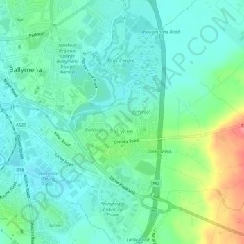
Name: Ballykeel topographic map, elevation, terrain.
Average elevation: 190 ft
Minimum elevation: 125 ft
Maximum elevation: 371 ft
Other topographic maps
Click on a map to view its topography, its elevation and its terrain.
Dunclug
United Kingdom > Northern Ireland > Ballymena
Dunclug, Ballymena, County Antrim, Northern Ireland, United Kingdom
Average elevation: 240 ft