San Antonio topographic map
Interactive map
Click on the map to display elevation.
About this map
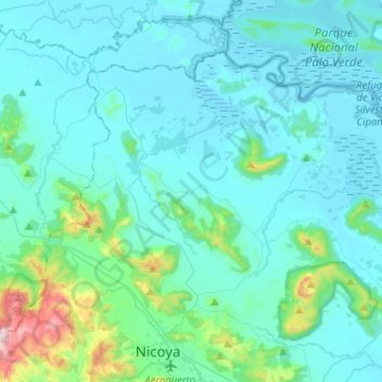
Name: San Antonio topographic map, elevation, terrain.
Average elevation: 341 ft
Minimum elevation: -3 ft
Maximum elevation: 3,002 ft

Click on the map to display elevation.
Name: San Antonio topographic map, elevation, terrain.
Average elevation: 341 ft
Minimum elevation: -3 ft
Maximum elevation: 3,002 ft