
La Ceiba topographic map
Interactive map
Click on the map to display elevation.
About this map
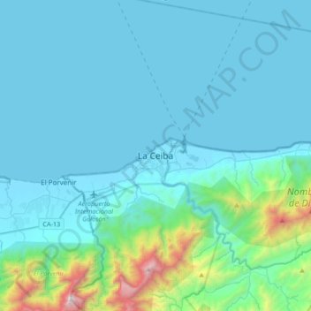
Name: La Ceiba topographic map, elevation, terrain.
Location: La Ceiba, Atlántida, La Ceiba, 31101, Honduras (15.62337 -86.95177 15.94337 -86.63177)
Average elevation: 830 ft
Minimum elevation: -3 ft
Maximum elevation: 7,720 ft
Other topographic maps
Click on a map to view its topography, its elevation and its terrain.
Sambo Creek
Honduras > Atlántida > La Ceiba > Sambo Creek
Sambo Creek, La Ceiba, Atlántida, Honduras
Average elevation: 240 ft