
Diamond Lake topographic map
Interactive map
Click on the map to display elevation.
About this map
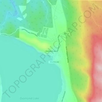
Name: Diamond Lake topographic map, elevation, terrain.
Location: Diamond Lake, Douglas County, Oregon, USA (43.15874 -122.15892 43.19874 -122.11892)
Average elevation: 5,371 ft
Minimum elevation: 5,056 ft
Maximum elevation: 6,043 ft