
Matale topographic map
Interactive map
Click on the map to display elevation.
About this map
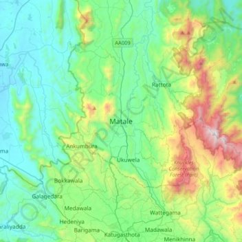
Name: Matale topographic map, elevation, terrain.
Location: Matale, Matale District, Central Province, 21000, Sri Lanka (7.31213 80.46342 7.63213 80.78342)
Average elevation: 1,745 ft
Minimum elevation: 410 ft
Maximum elevation: 6,109 ft