
Sonneberg topographic map
Interactive map
Click on the map to display elevation.
About this map
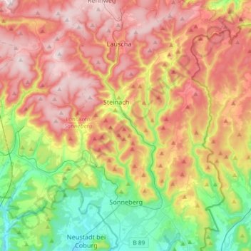
Name: Sonneberg topographic map, elevation, terrain.
Location: Sonneberg, Landkreis Sonneberg, Thuringia, 96515, Germany (50.32086 11.11405 50.50751 11.28479)
Average elevation: 1,923 ft
Minimum elevation: 1,073 ft
Maximum elevation: 2,841 ft