
Topsham topographic map
Interactive map
Click on the map to display elevation.
About this map
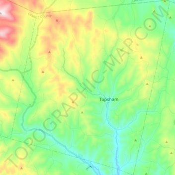
Name: Topsham topographic map, elevation, terrain.
Location: Topsham, Orange County, Vermont, USA (44.06601 -72.33137 44.19266 -72.17069)
Average elevation: 1,490 ft
Minimum elevation: 709 ft
Maximum elevation: 3,110 ft