
Kutchan topographic map
Interactive map
Click on the map to display elevation.
About this map
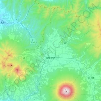
Name: Kutchan topographic map, elevation, terrain.
Average elevation: 1,227 ft
Minimum elevation: 20 ft
Maximum elevation: 6,148 ft
Other topographic maps
Click on a map to view its topography, its elevation and its terrain.
Niseko
Niseko, Abuta County, Shiribeshi Subprefecture, Hokkaido Prefecture, Japan
Average elevation: 1,112 ft