
Mangystau District topographic map
Interactive map
Click on the map to display elevation.
About this map
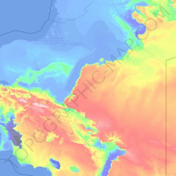
Name: Mangystau District topographic map, elevation, terrain.
Location: Mangystau District, Mangystau Region, Kazakhstan (43.44758 51.02878 45.60783 56.00053)
Average elevation: 236 ft
Minimum elevation: -427 ft
Maximum elevation: 1,719 ft
Other topographic maps
Click on a map to view its topography, its elevation and its terrain.
Aktau
Kazakhstan > Mangystau Region > Aktau
Aktau, Актау Г.А., Mangystau Region, 130000, Kazakhstan
Average elevation: -43 ft
Sherkala
Sherkala, Mangystau District, Mangystau Region, Kazakhstan
Average elevation: 440 ft