
Prešov topographic map
Interactive map
Click on the map to display elevation.
About this map
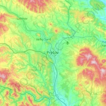
Name: Prešov topographic map, elevation, terrain.
Location: Prešov, Region of Prešov, Eastern Slovakia, 08001, Slovakia (48.83763 21.08019 49.15763 21.40019)
Average elevation: 1,417 ft
Minimum elevation: 597 ft
Maximum elevation: 3,524 ft