
Tshuapa topographic map
Interactive map
Click on the map to display elevation.
About this map
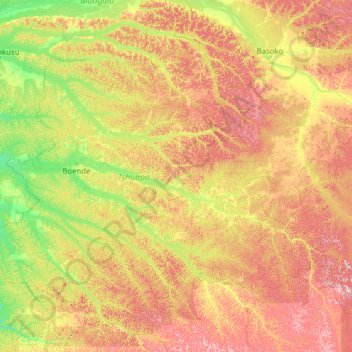
Name: Tshuapa topographic map, elevation, terrain.
Location: Tshuapa, Democratic Republic of the Congo (-2.66879 19.46000 1.76262 24.41239)
Average elevation: 1,365 ft
Minimum elevation: 1,030 ft
Maximum elevation: 2,270 ft
Other topographic maps
Click on a map to view its topography, its elevation and its terrain.
Boende
Democratic Republic of the Congo > Tshuapa
Boende, Tshuapa, Democratic Republic of the Congo
Average elevation: 1,122 ft