
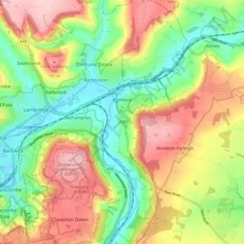
Bathford topographic map
Interactive map
Click on the map to display elevation.
About this map
Name: Bathford topographic map, elevation, terrain.
Average elevation: 341 ft
Minimum elevation: 52 ft
Maximum elevation: 692 ft
Other topographic maps
Click on a map to view its topography, its elevation and its terrain.
Bath
United Kingdom > England > Bath and North East Somerset
Bath, Bath and North East Somerset, West of England, England, United Kingdom
Average elevation: 328 ft
Hallatrow
United Kingdom > England > Bath and North East Somerset > High Littleton
Hallatrow, High Littleton, Bath and North East Somerset, West of England, England, BS39 6WD, United Kingdom
Average elevation: 390 ft
Priston
United Kingdom > England > Bath and North East Somerset
Priston, Bath and North East Somerset, West of England, England, United Kingdom
Average elevation: 348 ft
Chew Stoke
United Kingdom > England > Bath and North East Somerset
Chew Stoke, Bath and North East Somerset, West of England, England, United Kingdom
Average elevation: 256 ft
Publow
United Kingdom > England > Bath and North East Somerset
Publow, Bath and North East Somerset, West of England, England, United Kingdom
Average elevation: 249 ft
Monkton Combe
United Kingdom > England > Bath and North East Somerset
Monkton Combe, Bath and North East Somerset, West of England, England, United Kingdom
Average elevation: 335 ft
Stowey
United Kingdom > England > Bath and North East Somerset
Stowey, Bath and North East Somerset, West of England, England, BS39 5TH, United Kingdom
Average elevation: 358 ft
Tadwick
United Kingdom > England > Bath and North East Somerset > Swainswick
Tadwick, Swainswick, Bath and North East Somerset, West of England, England, BA1 8AH, United Kingdom
Average elevation: 528 ft
Carlingcott
United Kingdom > England > Bath and North East Somerset > Peasedown St. John
Carlingcott, Peasedown St. John, Bath and North East Somerset, West of England, England, BA2 8AW, United Kingdom
Average elevation: 404 ft
Wellow
United Kingdom > England > Bath and North East Somerset
Wellow, Bath and North East Somerset, West of England, England, United Kingdom
Average elevation: 325 ft
North Wick
United Kingdom > England > Bath and North East Somerset > Chew Magna
North Wick, Chew Magna, Bath and North East Somerset, West of England, England, BS41 8NN, United Kingdom
Average elevation: 361 ft
Compton Martin
United Kingdom > England > Bath and North East Somerset
Compton Martin, Bath and North East Somerset, West of England, England, United Kingdom
Average elevation: 344 ft
Hinton Charterhouse
United Kingdom > England > Bath and North East Somerset
Hinton Charterhouse, Bath and North East Somerset, West of England, England, United Kingdom
Average elevation: 308 ft
Southstoke
United Kingdom > England > Bath and North East Somerset
Southstoke, Bath and North East Somerset, West of England, England, United Kingdom
Average elevation: 364 ft
Mearns
United Kingdom > England > Bath and North East Somerset > Farmborough
Mearns, Farmborough, Bath and North East Somerset, West of England, England, BS39 6JR, United Kingdom
Average elevation: 423 ft
Chewton Keynsham
United Kingdom > England > Bath and North East Somerset > Compton Dando
Chewton Keynsham, Compton Dando, Bath and North East Somerset, West of England, England, BS31 2SW, United Kingdom
Average elevation: 187 ft
Cameley
United Kingdom > England > Bath and North East Somerset
Cameley, Bath and North East Somerset, West of England, England, United Kingdom
Average elevation: 427 ft
Bathampton
United Kingdom > England > Bath and North East Somerset
Bathampton, Bath and North East Somerset, West of England, England, United Kingdom
Average elevation: 243 ft
Whitley Batts
United Kingdom > England > Bath and North East Somerset > Pensford
Whitley Batts, Publow, Pensford, Bath and North East Somerset, West of England, England, BS39 4NE, United Kingdom
Average elevation: 285 ft
Timsbury
United Kingdom > England > Bath and North East Somerset
Timsbury, Bath and North East Somerset, West of England, England, United Kingdom
Average elevation: 417 ft
Chelwood
United Kingdom > England > Bath and North East Somerset
Chelwood, Bath and North East Somerset, West of England, England, United Kingdom
Average elevation: 351 ft
Wick Green
United Kingdom > England > Bath and North East Somerset > Bishop Sutton
Wick Green, Stowey-Sutton, Bishop Sutton, Bath and North East Somerset, West of England, England, BS39 5XR, United Kingdom
Average elevation: 269 ft
Bathwick Hill
United Kingdom > England > Bath and North East Somerset > Bath
Bathwick Hill, Bathwick, Bath, Bath and North East Somerset, West of England, England, BA2 6JY, United Kingdom
Average elevation: 305 ft
Sydney Gardens
United Kingdom > England > Bath and North East Somerset > Bath
Sydney Gardens, Bathwick, Bath, Bath and North East Somerset, West of England, England, United Kingdom
Average elevation: 253 ft
Sharpstone
United Kingdom > England > Bath and North East Somerset > Freshford
Sharpstone, Freshford, Bath and North East Somerset, West of England, England, BA2 7UA, United Kingdom
Average elevation: 305 ft
Chew Magna
United Kingdom > England > Bath and North East Somerset
Chew Magna, Bath and North East Somerset, West of England, England, United Kingdom
Average elevation: 295 ft
Saltford
United Kingdom > England > Bath and North East Somerset > Saltford
Saltford, Bath and North East Somerset, South West England, England, United Kingdom
Average elevation: 138 ft
Little Solsbury Hill
United Kingdom > England > Bath and North East Somerset > Batheaston
Little Solsbury Hill, Batheaston, Bath and North East Somerset, West of England, England, BA1 7JQ, United Kingdom
Average elevation: 289 ft
Radstock
United Kingdom > England > Bath and North East Somerset
Radstock, Bath and North East Somerset, West of England, England, United Kingdom
Average elevation: 384 ft
Compton Dando
United Kingdom > England > Bath and North East Somerset
Compton Dando, Bath and North East Somerset, West of England, England, United Kingdom
Average elevation: 223 ft
Batheaston
United Kingdom > England > Bath and North East Somerset
Batheaston, Bath and North East Somerset, West of England, England, United Kingdom
Average elevation: 374 ft
Keynsham
United Kingdom > England > Bath and North East Somerset
Keynsham, Bath and North East Somerset, West of England, England, United Kingdom
Average elevation: 151 ft
Maes Knoll
United Kingdom > England > Bath and North East Somerset > Norton Malreward
Maes Knoll, Norton Malreward, Bath and North East Somerset, South West England, England, BS39 4EY, United Kingdom
Average elevation: 361 ft
Nempnett Thrubwell
United Kingdom > England > Bath and North East Somerset
Nempnett Thrubwell, Bath and North East Somerset, West of England, England, United Kingdom
Average elevation: 364 ft
Midsomer Norton
United Kingdom > England > Bath and North East Somerset
Midsomer Norton, Bath and North East Somerset, West of England, England, United Kingdom
Average elevation: 374 ft
High Littleton
United Kingdom > England > Bath and North East Somerset
High Littleton, Bath and North East Somerset, West of England, England, United Kingdom
Average elevation: 400 ft
Peasedown St. John
United Kingdom > England > Bath and North East Somerset
Peasedown St. John, Bath and North East Somerset, West of England, England, United Kingdom
Average elevation: 410 ft
Hinton Blewett
United Kingdom > England > Bath and North East Somerset
Hinton Blewett, Bath and North East Somerset, West of England, England, United Kingdom
Average elevation: 397 ft
Norton Malreward
United Kingdom > England > Bath and North East Somerset
Norton Malreward, Bath and North East Somerset, West of England, England, United Kingdom
Average elevation: 341 ft
Paulton
United Kingdom > England > Bath and North East Somerset
Paulton, Bath and North East Somerset, West of England, England, United Kingdom
Average elevation: 377 ft
Park Corner
United Kingdom > England > Bath and North East Somerset > Freshford > Park Corner
Park Corner, Freshford, Bath and North East Somerset, South West England, England, BA2 7US, United Kingdom
Average elevation: 305 ft
Kelston
United Kingdom > England > Bath and North East Somerset > Kelston
Kelston, Bath and North East Somerset, South West England, England, United Kingdom
Average elevation: 236 ft
Marksbury
United Kingdom > England > Bath and North East Somerset
Marksbury, Bath and North East Somerset, West of England, England, United Kingdom
Average elevation: 322 ft
Claverton
United Kingdom > England > Bath and North East Somerset
Claverton, Bath and North East Somerset, West of England, England, United Kingdom
Average elevation: 381 ft
Pensford
United Kingdom > England > Bath and North East Somerset
Pensford, Bath and North East Somerset, West of England, England, BS39 4BQ, United Kingdom
Average elevation: 246 ft
Englishcombe
United Kingdom > England > Bath and North East Somerset
Englishcombe, Bath and North East Somerset, West of England, England, United Kingdom
Average elevation: 341 ft
Farrington Gurney
United Kingdom > England > Bath and North East Somerset
Farrington Gurney, Bath and North East Somerset, West of England, England, United Kingdom
Average elevation: 387 ft
Farmborough
United Kingdom > England > Bath and North East Somerset
Farmborough, Bath and North East Somerset, West of England, England, United Kingdom
Average elevation: 449 ft
Corston
United Kingdom > England > Bath and North East Somerset
Corston, Bath and North East Somerset, West of England, England, United Kingdom
Average elevation: 217 ft
Upper Swainswick
United Kingdom > England > Bath and North East Somerset > Swainswick
Upper Swainswick, Swainswick, Bath and North East Somerset, West of England, England, BA1 8DB, United Kingdom
Average elevation: 407 ft