
Dewey Lake topographic map
Interactive map
Click on the map to display elevation.
About this map
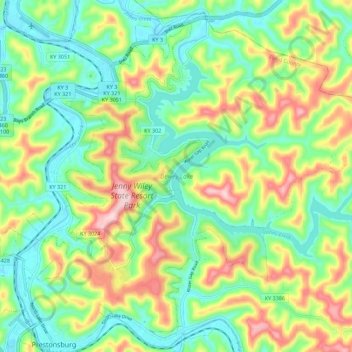
Name: Dewey Lake topographic map, elevation, terrain.
Average elevation: 896 ft
Minimum elevation: 594 ft
Maximum elevation: 1,427 ft
Other topographic maps
Click on a map to view its topography, its elevation and its terrain.
Prestonsburg
United States > Kentucky > Floyd County > Prestonsburg > Prestonsburg
Prestonsburg, Floyd County, Kentucky, 41653, United States
Average elevation: 899 ft