
西螺鎮 topographic map
Interactive map
Click on the map to display elevation.
About this map
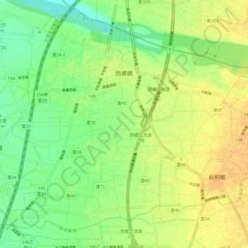
Name: 西螺鎮 topographic map, elevation, terrain.
Location: 西螺鎮, Comté de Yunlin, 臺灣省, Taïwan (23.73835 120.41651 23.82076 120.51334)
Average elevation: 98 ft
Minimum elevation: 49 ft
Maximum elevation: 144 ft