
Penang Hill topographic map
Interactive map
Click on the map to display elevation.
About this map
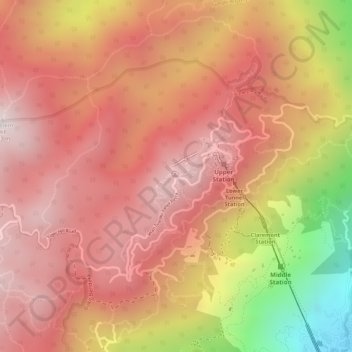
Name: Penang Hill topographic map, elevation, terrain.
Location: Penang Hill, George Town, Timur Laut, Penang, 11500, Malaysia (5.42267 100.26572 5.42277 100.26582)
Average elevation: 1,850 ft
Minimum elevation: 125 ft
Maximum elevation: 2,628 ft
Other topographic maps
Click on a map to view its topography, its elevation and its terrain.
Bukit Penara
Malaysia > Penang > George Town
Bukit Penara, George Town, Timur Laut, Penang, 11500, Malaysia
Average elevation: 1,030 ft