
Tafea topographic map
Interactive map
Click on the map to display elevation.
About this map
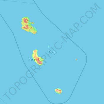
Name: Tafea topographic map, elevation, terrain.
Location: Tafea, Vanuatu (-20.46274 168.35376 -18.27167 170.44998)
Average elevation: 23 ft
Minimum elevation: 0 ft
Maximum elevation: 3,189 ft
Other topographic maps
Click on a map to view its topography, its elevation and its terrain.
TAFEA Provincial Disaster Committee
TAFEA Provincial Disaster Committee, Nakepau, Lénakel, Tafea, Vanuatu
Average elevation: 240 ft
Etas
Vanuatu > Shefa Province > Port Vila > Etas
Etas, Port Vila, Shefa Province, Vanuatu
Average elevation: 171 ft
Cook Reef
Vanuatu > Shefa Province > Port Vila
Cook Reef, Port Vila, Shefa Province, Vanuatu
Average elevation: 0 ft