
Hogeun-dong topographic map
Interactive map
Click on the map to display elevation.
About this map
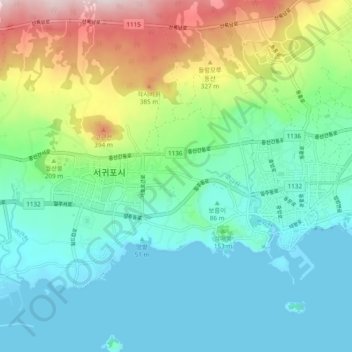
Name: Hogeun-dong topographic map, elevation, terrain.
Location: Hogeun-dong, Seogwipo, Jeju, 587, South Korea (33.21632 126.49351 33.29632 126.57351)
Average elevation: 469 ft
Minimum elevation: -3 ft
Maximum elevation: 1,765 ft