
Haverfordwest topographic map
Interactive map
Click on the map to display elevation.
About this map
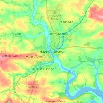
Name: Haverfordwest topographic map, elevation, terrain.
Location: Haverfordwest, Pembrokeshire, Wales, SA61 2NL, United Kingdom (51.76233 -5.00511 51.84233 -4.92511)
Average elevation: 135 ft
Minimum elevation: 0 ft
Maximum elevation: 341 ft